Maharashtra Introduction :
The economic and commercial capital of India is called the Mumbai city of Maharashtra. Maharashtra is one of the richest and most prosperous states of India.
Maharashtra contributes the most to India’s GDP. Maharashtra is also the most industrialized state of the country.
The world’s largest onion market is found in Nashik district of Maharashtra and every year half of the world’s onions are produced in Nashik district alone.
India’s first train ran in Maharashtra, which ran from Mumbai to Thane in 1853. India’s first nuclear power plant Tarapur is located in Maharashtra.
Maharashtra, the land of work of Chhatrapati Shivaji, is considered the most important state of India. This state is the second largest state in the country on the basis of population and the third largest state on the basis of area.
Maharashtra is the main center of Indian film and television industry. India’s first film was made in Maharashtra, which was made by Dadasaheb Phalke in Nashik district.
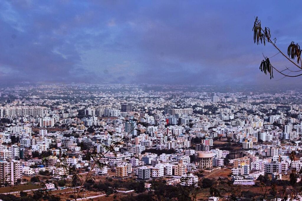
Maharashtra is a state in India which has two metro cities, one is Mumbai and the other is Pune. Ganesh Chaturthi is an important festival of this state.
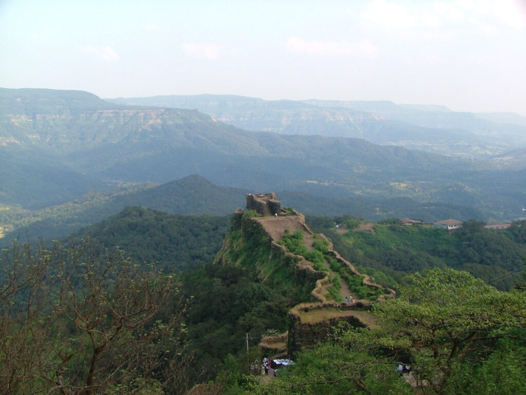
There are 350 forts here. Most of these forts are associated with the great Maratha ruler Chhatrapati Shivaji Maharaj.
General facts about:
Foundation Day: 1 May 1960
Capital: Mumbai
Total Area: 307,713 sq km
Total Districts: 36
Largest City: Mumbai
First Chief Minister: Yashwantrao Chavan
State Language: Marathi
State Bird: Yellow-footed Green Pigeon
State Animal: Indian Giant Squirrel
State Tree: Mango Tree
State Flower: Jarul
State Sport: Kabaddi
State Butterfly: Blue Morgan
Border of Maharashtra: Arabian Sea, Karnataka, Goa, Telangana, Chhattisgarh, Gujarat, Madhya Pradesh and Dadra and Nagar Haveli
Major Rivers: Godavari, Girna River, Mutha, Mula, Savitri, Ulhas, Krishna, Panchganga, Koyna, Bhima
Population: 11,23,74,333 (based on 2011 census)
Literacy Rate: 82.3%
Major Agricultural Industries: Sugarcane, Wheat, Orange, Cotton, Soybean
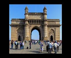
Tourist Places: Gateway of India, Elephanta Island, Shirdi Sai Baba Temple, Ajanta-Ellora Caves, Ratnagiri, Haji Ali Dargah etc.
Main Dances: Lavani, Tamasa, Dadhi, Handi, Koli
History of Maharashtra:
Maharashtra state was formed by combining the western and south-western parts of Bombay state, Berar and Vidarbha and the north-western parts of Hyderabad state.
Many kings ruled Maharashtra. After the fall of Mauryas, Yadavas arrived in the year 230. After this, the Chalukyas ruled.
Then the Rashtrakutas, and again the Chalukyas ruled. Later, Alauddin Khilji of the Khilji dynasty expanded his empire. Then the Marathas ruled.
By the end of the 18th century, the power of the Marathas spread to almost the whole of Maharashtra. After this, this state became a part of the British Empire.
Thus, before Indian independence, Maharashtra was ruled by the Satavahana dynasty, Rashtrakuta dynasty, Western Chalukyas, Deccan Sultanate, Mughals and Marathas, and the British.
The British governed western Maharashtra as part of the Bombay Presidency, which covered an area from Karachi in Pakistan to the northern Deccan. Nizam Hyderabad remained part of the state during British rule.
When were the states of Maharashtra and Gujarat separated?
After independence, Mumbai province comprised Maharashtra and Gujarat. Later, under the Mumbai Reorganisation Act, 1960, two separate states were created, namely Marathi speaking Maharashtra and Gujarat, when there was massive protest against the bilingual Mumbai state on 1 May 1960.
This state is the land of freedom fighters like Bal Gangadhar Tilak, Vinayak Savarkar, Govind Ranade, Gopal Krishna Gokhale, Dadabhai Naoroji and Pherozeshah Mehta, who fought many struggles and movements against the British for freedom in the early 20th century.
What is the north-south and east-west extension of Maharashtra?
The total extension of Maharashtra from east to west is 800 km and from north to south is 720 km respectively. This state is surrounded by the Arabian Sea in the west, whose total coastline length is 720 km.
What is the geographical location of Maharashtra?
The geographical location of Maharashtra state is spread from northern latitude 15044’ to 22006’ and eastern longitude 72036’ to 80054’.
Maharashtra state is the third largest state after Madhya Pradesh and Rajasthan in terms of area and the second largest state in terms of population.
The largest district of this state is Ahmednagar, whose total area is 17413 square kilometers and the smallest district is Mumbai city, whose total area is 157 square kilometers.
Mumbai district is the largest in terms of population.
The capital of this state is Mumbai and the sub-capital is Nagpur. The area of this state is spread over 9.36% of the total area of India.
The state of Maharashtra is divided into 5 territorial divisions.
- Konkan Regional Department, which includes 7 districts.
- West Maharashtra Regional Department, which includes 7 districts.
- Khandesh Regional Department, which includes 3 districts.
- Marathwada Regional Department, which includes 8 districts.
- Vidarbha Regional Department, which includes 11 districts.
Maharashtra is bordered by the Arabian Sea in the west, Karnataka and Goa in the south, Telangana in the south-east, Chhattisgarh in the east, Gujarat and Madhya Pradesh in the north and the Indian Union Territory of Dadra Nagar Haveli and Daman Diu in the north-west.
The landform of the state of Maharashtra is like an asymmetric triangle, the base of which is the western coast. The coastal plain of this state is called the Konkan coast, which is located on the Arabian Sea. To the east of Konkan, the Sahyadri mountain range lies parallel to the sea.
Tourist Places in Maharashtra :
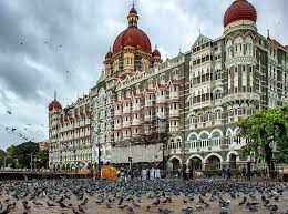
Mumbai: There are many places like Gateway of India, Marine Drive, Juhu Beach, Sanjay Gandhi National Park, Tungareshwar National Park, Siddhivinayak Temple etc. which you can see in Mumbai.
Tadoba Andhari National Park: Which comes in Chandrapur district. Where you will get to see nature closely.
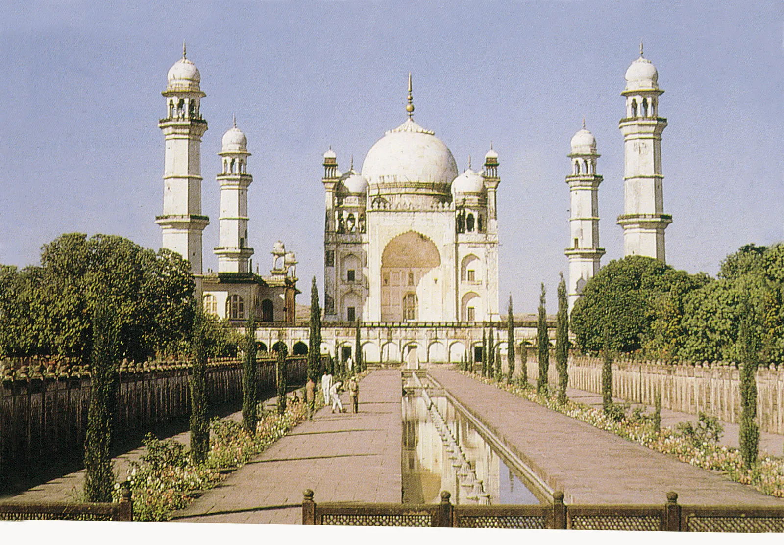
Aurangabad: Where you have the tomb and the cave of Ajanta-Ellora which is a very historical place.
Nashik: Here one of the twelve Jyotirlingas is in Trimbakeshwar near Nashik. Apart from this, there are many good places in Nashik like Jain temple, museum etc. where you can go.
Mahabaleshwar: This is a hill station, where you have Sunset Point, Pratapgarh where you can see a very important and historical fort of Chhatrapati Shivaji Maharaj.
Kolhapur: This place is known for being a place for wrestlers. Apart from this, there is a Mahalakshmi temple and Krankala pond which are very famous.
Lonavala: Where you can enjoy visiting the dam and Khandala Ghat.
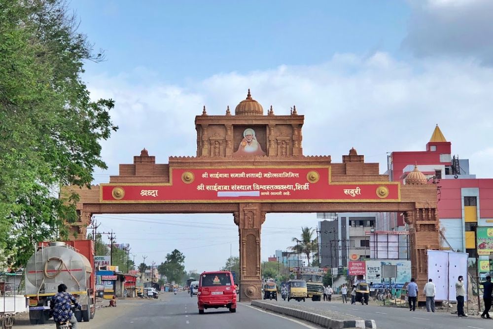
Shirdi: Which comes in Ahmednagar district. Where there is a Sai Baba temple and a voter park as well.

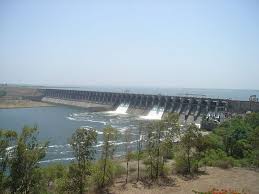
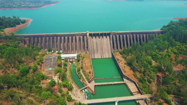
Which are the major dams of Maharashtra?
Koyna Dam: Built on the Koyna River, it is located in Satara district.
Jayakwadi Dam: Built on the Godavari River. This dam is located in Jayakwadi village of Paithan taluka of Aurangabad district.
Ujjani Dam: Built on the Bhima River, it is also known as Bhima Dam. It is a tributary of the Krishna River and is located near Ujjani village in Solapur.
Isapur Dam: Built on the Paiganga River, it is located in Hingoli, Nanded region.
Totaldoh Dam: Built on the Pench River near Ramtek in Nagpur, it is a gravity dam.
Information about Dharavi slum in Mumbai:
Mumbai city of Maharashtra is called the city of dreams, but there is a place here called Dharavi where there is no place for people to live. This is the largest slum area of Mumbai and India, as well as the second largest area in Asia.
About 7 lakh people live in an area of 2.1 square kilometers. The history of Dharavi is about 140 years old. In the year 1869, when a terrible disease called plague spread in Mumbai, more than 2 lakh people died.
With the idea of not having such diseases in future, the British at that time started settling the pollution and disease spreading industries like leather industry and the workers associated with them on the banks of Mithi River. Which finally came to be known as Dharavi Slum in 1882.
Dharavi, which is Asia’s largest slum located in the central part of Mumbai city, has become a small industrial state today with the efforts of Shramik Vidyapeeth.
