Madhya Pradesh is the second largest state in India after Rajasthan with an area of 3,08,000 sq km. It is a part of the peninsular plateau situated in the north-central part of India, bordered by the Gangetic plains on the north, the Aravallis in the west, the Chhattisgarh plains in the east and the Tapti Valley and the Maharashtra plateau in the south. The topography of Madhya Pradesh is defined by the Narmada-Son Valley. It is a narrow and long valley extending from east to west across the state.
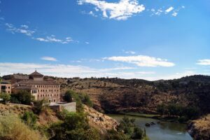
The Son Valley forms the upper part, Shahdol and Sidhi districts are situated in this valley. The lower part is formed by the Narmada Valley. The average elevation here is 300 m above MSL and the land here is covered with alluvial soil. The districts of Jabalpur, Mandla, Narsinghpur, Hoshangabad, Raisen, Khandwa, Khargone and Barwani come under this region. The Narmada valley is narrower than the Son valley and the alluvium deposited is also comparatively poor and thin, so the Narmada valley is more important than the Son valley for agricultural activities. The valley is bordered by the Central Hill Tracts to the north, the Satpura-Maikal ranges to the south and the Eastern Plateau to the south-east.
l regions. The Central Hill Tracts extend in the west in a triangular shape between the Narmada-Son Valley and the Aravalli ranges. The hilly areas slope northwards and merge into the Yamuna. The Central Hill Tracts of the state consist of the following four uplands: The Rewa-Panna Plateau, also known as the Vindhya Plateau, is located in the north-eastern part of the Central Hill Tracts. The main rivers flowing in this region include Ken, Sonar, Barna and Ton. The districts of Rewa, Panna, Satna, Damoh and Sagar come in this region.
Bundelkhand, situated to the north-west of the Rewa-Panna plateau, is another plateau. The northern part of the state is formed by the districts of Datia, Chhatarpur, Panna, Tikamgarh and Guna and Shivpuri situated in this region. This plateau is surrounded by the natural slope of the Vindhya or Rewa-Panna plateau in the north-east. The average height of the region is 350-450 metres above MSL and its general slope is towards the north. Betwa, Dhasan and Jamner are the main rivers flowing in this region, which finally join the Yamuna. Madhya Bharat, situated to the west of the Bundelkhand plateau, is the third plateau. Shivpuri, Morena and Gwalior districts are present in this region. The hilly areas of this plateau have an average height of 150-450 metres and the valleys have an average height of 450 metres above MSL. Chambal, Kali Sindh and Parvati are the main rivers flowing in this region.
The fourth Malwa plateau includes almost the whole of western Madhya Pradesh. The plateau is bordered by the Chambal to the north and the Narmada to the south. The average elevation of the range is 300–500 m above MSL. The region includes Shajapur, Dewas, Indore, Ujjain, Dhar, Ratlam and parts of Sehore and Jhabua district. Bhopal is situated on the eastern edge of the Malwa Plateau. The rivers Shipra, Parvati, Kali Sindh, Gambhir and Chambal flow through the Malwa Plateau. It also separates the flow of the Ganga and the Narmada. The soil of the region is black as a result of basaltic weathering.
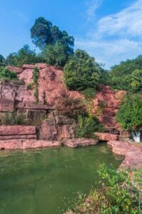
The Satpura-Maikal range lies to the north-east of the Narmada-Son valley and in the southern and eastern plateau region. Chhindwara, Betul, Seoni, Balaghat, Mandla and parts of Khandwa and Khargone districts lie in the Satpura-Maikal range. The average height of these ranges is 300 metres, but there are some higher peaks too, including Dhoopgarh, 1360 metres high, the highest peak in the state. The slope is steep in the south and gentle on the northern side. The eastern part, i.e. Satpura, spread in the form of a semi-circle, is wider than the western part, known as the Maikal range.

The Maikal range includes the Amarkantak plateau, which is the origin of both the rivers Narmada and Son. Johila, Macherwa, Denwa and Chhoti Tawa are other rivers of this region, which merge into the Narmada. Baghel Khand Plateau is situated in the eastern plateau region nestled between the Maikal range and the plains of Chhattisgarh, located at an altitude of 1033 m above MSL.
Madhya Pradesh is a state of India, its official capital is Bhopal. Madhya Pradesh was the largest state of India in terms of area until 1 November 2000. On this day, Chhattisgarh state was formed by separating 16 districts from Madhya Pradesh state. Madhya Pradesh shares its borders with five states. It has Uttar Pradesh in the north, Chhattisgarh in the east, Maharashtra in the south, Gujarat in the west, and Rajasthan in the north-west.
Modern History of Madhya Pradesh
Madhya Pradesh was a strong hold of Mughal emperor Akbar from 1556 to 1605. After Aurangzeb died in 1707, the Mughal Empire declined and Marathas began to control over the state. Between 1720 and 1760 the Marathas took control of most of Madhya Pradesh, and Maratha clans established semi-autonomous states under the nominal control of the Maratha Peshwa. The power of the Marathas came into an end in 1761 after the defeat in the battle of Panipat. In between 18th and 19th century the British were expanding their dominion in India from bases in Kolkata, Mumbai and Chennai. Most of Madhya Pradesh came under British Supremacy when the British won the third Anglo-Maratha War. Then the regions including Indore, Bhopal, Nagpur, Rewa, and dozens of other small areas became princely states of British India.
When India got her independence in 1947, the former British Central Provinces and Berar and the princely states of Makrai and Chhattisgarh were made a separate state with Nagpur as the capital. In 1956, the states of Madhya Bharat, Vindhya Pradesh, and Bhopal were merged into Madhya Pradesh, and the Marathi-speaking southern region Vidarbha, which included Nagpur, was ceded to Bombay state. Then Bhopal became the new capital of Madhya Pradesh. Madhya Pradesh remained as the largest state of the country from 1956 to 2000. In November 2000, as part of the Madhya Pradesh Reorganization Act, the southeastern portion of the state carved out to form the new state of Chhattisgarh with a huge tribal population.
8 thoughts on “Do you know this thing about Madhya Pradesh? 2 Largest State”